Frodsham Marsh
Map reference: Main access SJ511784
Link to Frodsham Marsh information.
Click link to download a pdf file of the Frodsham Marshes map
Imagine the scene, it’s the first week of September and the skies are blue, with a brisk wind bringing with it the threat of a deepening depression from the south-west. Before you lies acres of closely cropped grassy saltmarsh stretching out 1800 ahead. In the distance the Mersey mudflats are slowly covered by an advancing ten metre tide and in the air the song of a Skylark hangs. Then select the best position to sit to view from the raised embankment of No4 tank. With the sunlight to your back and the breeze to your side, the conditions are near perfect to watch the spectacle unfold on the score ahead.
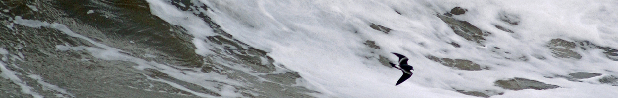
The murky, grey-brown waters of the river move ever closer inshore and in the distance the alternating flashes of a large flock of Dunlin catch your eye, followed by a long line of black and white Oystercatchers and the bubbling cries of Curlew. Suddenly an explosion of roosting Lapwings takes to the wing and, there overhead, a majestic Peregrine falcon folds its wings as it hurtles down towards a flock of panic stricken Teal and becomes lost in a confusion of birds. Inexperienced sheep grazing by the tideline now find themselves cut off by the encroaching surge and bleat cries of concern as they begin to wade to safety. Relentlessly the water moves forward, filling the channels and forking out on to the marsh, forcing the reluctant roosting birds from their slumber to find security in tighter assembled groups, closer to the banks of the Ship Canal and within scoping distance to you.
On a good tide and from a single position one can expect to see over 80 species including 23 species of wader. In recent years Little Egret, Brent Goose, Ruddy Shelduck, Velvet Scoter, Osprey, Glaucous Gull, Common and Black Tern have been found.
Access to the site is situated via Marsh Lane in Frodsham village. Follow the road over the motorway and bear left along the tarmac road (the right fork takes you towards the logbook area). Continue along this road to where it joins a dirt track. Take this lower left-hand track, keeping the raised embankments of No6 and No4 to your right, for about three miles or until you reach a small concrete bridge which crosses a channel (Hoole Pool Gutter). Park just before this bridge, then with the No4 bank still on your right, walk along the grassy track for 1/4 mile to low, iron barrier-gates. From here, walk towards the river, still keeping the raised bank to your right. Select the best position to view from and enjoy the experience!
Bill Morton
(Bird News 41 January 1999 & Bird News 47 July 2000)
Map reference: Main access SJ511784
Link to Frodsham Marsh information.
Click link to download a pdf file of the Frodsham Marshes map
Imagine the scene, it’s the first week of September and the skies are blue, with a brisk wind bringing with it the threat of a deepening depression from the south-west. Before you lies acres of closely cropped grassy saltmarsh stretching out 1800 ahead. In the distance the Mersey mudflats are slowly covered by an advancing ten metre tide and in the air the song of a Skylark hangs. Then select the best position to sit to view from the raised embankment of No4 tank. With the sunlight to your back and the breeze to your side, the conditions are near perfect to watch the spectacle unfold on the score ahead.
The murky, grey-brown waters of the river move ever closer inshore and in the distance the alternating flashes of a large flock of Dunlin catch your eye, followed by a long line of black and white Oystercatchers and the bubbling cries of Curlew. Suddenly an explosion of roosting Lapwings takes to the wing and, there overhead, a majestic Peregrine falcon folds its wings as it hurtles down towards a flock of panic stricken Teal and becomes lost in a confusion of birds. Inexperienced sheep grazing by the tideline now find themselves cut off by the encroaching surge and bleat cries of concern as they begin to wade to safety. Relentlessly the water moves forward, filling the channels and forking out on to the marsh, forcing the reluctant roosting birds from their slumber to find security in tighter assembled groups, closer to the banks of the Ship Canal and within scoping distance to you.
On a good tide and from a single position one can expect to see over 80 species including 23 species of wader. In recent years Little Egret, Brent Goose, Ruddy Shelduck, Velvet Scoter, Osprey, Glaucous Gull, Common and Black Tern have been found.
Access to the site is situated via Marsh Lane in Frodsham village. Follow the road over the motorway and bear left along the tarmac road (the right fork takes you towards the logbook area). Continue along this road to where it joins a dirt track. Take this lower left-hand track, keeping the raised embankments of No6 and No4 to your right, for about three miles or until you reach a small concrete bridge which crosses a channel (Hoole Pool Gutter). Park just before this bridge, then with the No4 bank still on your right, walk along the grassy track for 1/4 mile to low, iron barrier-gates. From here, walk towards the river, still keeping the raised bank to your right. Select the best position to view from and enjoy the experience!
Bill Morton
(Bird News 41 January 1999 & Bird News 47 July 2000)
© All images copyright of the author 2025
Cheshire and Wirral
Ornithological Society
Ornithological Society
Registered Charity No. 702484